Research Projects
LLM-based Agentic Framework for National Water Model Data Access, Insight Generation, and Decision Support
July 2025 - Present (in progress)Supervisor: Professor Dr. Dan Ames
This project attempts to develop an agentic AI system around the National Water Model and relevant data products by employing generic and hydrology-domain pretrained large-language models as the intelligent units. Through the interactions among agents, the system will process user prompts to identify tasks and execute them through a set of tools by running agent-triggered workflows. The objectives are to expedite and automate data access and decision support by generating data, visualizations, and reports.
Improving National Water Model Evapotranspiration Estimates Through Tower Observations and Machine Learning
May 2025 - Present (in progress)
It is a collaborative project (post-defense) around a chapter of the thesis of another graduate student (former), Chapagain, A.R. The corresponding work aims to enhance the NWM forecasted middle-range evapotranspiration product by using eddy-covariance tower data and the NWM native forcing data as input features. Three tree-based ML models, Random Forest, XGBoost, and LightGBM, were tried for the post-processing. For my part, I have been contributing by reviewing the contents, revising as per the recommendations from internal reviewers, cleaning the codes, and post-auditing the performed machine learning model runs.
Enhanced and Expanded API for National Water Model Data Access
January 2025 - Present (in progress) Supervisor: Professor Dr. Dan Ames
The API developed and deployed by CIROH facilitated NWM data access with its configuration-based endpoints for user convenience and flexibility. However, this API still lacks characteristics and data products that a larger community of water researchers and professionals will find helpful. New NWM-derived data products, such as return periods and indices, can enable moving towards actionable intelligence. Moreover, we can leverage the geospatial aspect of the data by allowing geographic queries for precise location filtering. Additionally, the API has room for adjustments to make it compatible with large-language models and corresponding agent systems. This project aims to implement a redesigned API to accommodate these enhancements.
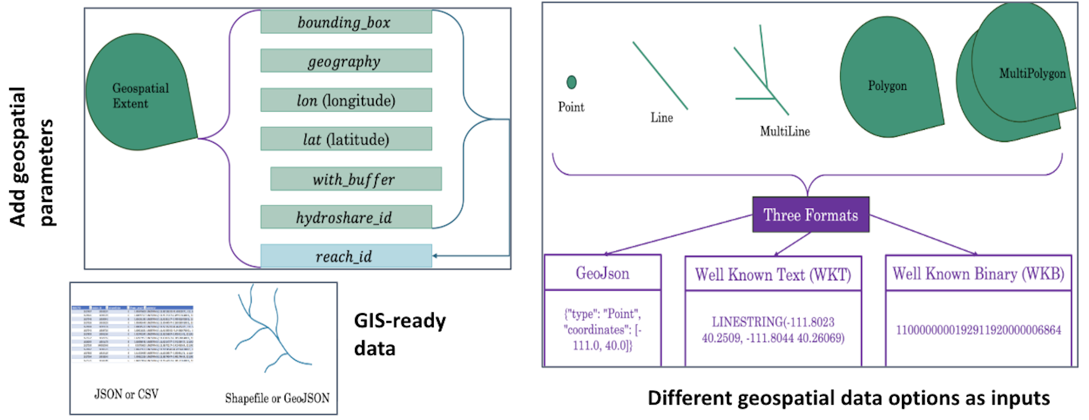
Figure: New Geospatial Features
Extending the Operational CIROH NWM API with the Return Period endpoint
November 2024 - February 2025 Supervisor: Professor Dr. Dan Ames
This mini project involved creating a new endpoint for the operational API, serving National Water Model datasets, officially deployed by CIROH. A former lab member, Markert, K.N., created a new return period dataset in BigQuery. I appended the Python FASTAPI code to create another REST endpoint to facilitate access to this dataset with consistent parameters.
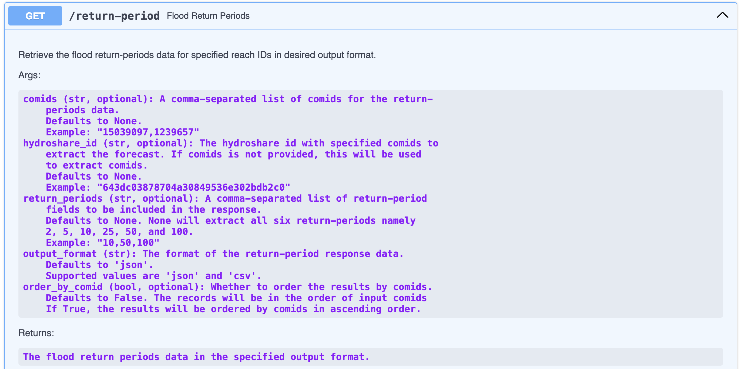
Figure: Return Period Endpoint Documented
A Deep Learning Approach Using Long Short-Term Memory Networks for Enhanced Prediction of Rainfall in the Northeastern Region of Bangladesh
This study explored a long short-term memory (LSTM) network-based deep learning approach for predicting rainfall, considering its inherent suitability for time-series data, against the limitations of traditional ML models. A large dataset of the monthly values of various hydrometeorological variables, including rainfall, temperature, humidity, windspeed, and cloud cover, for more than 66 years (1956–2021), was used as the input to predict the one-month-ahead monthly rainfall for Sylhet and Srimangal stations in the northeast region of Bangladesh. The results indicated that the LSTM network-based deep learning approach provided enhanced rainfall prediction and accordingly outperformed the individual ANN and SVM techniques in terms of prediction accuracy based on different model performance criteria.
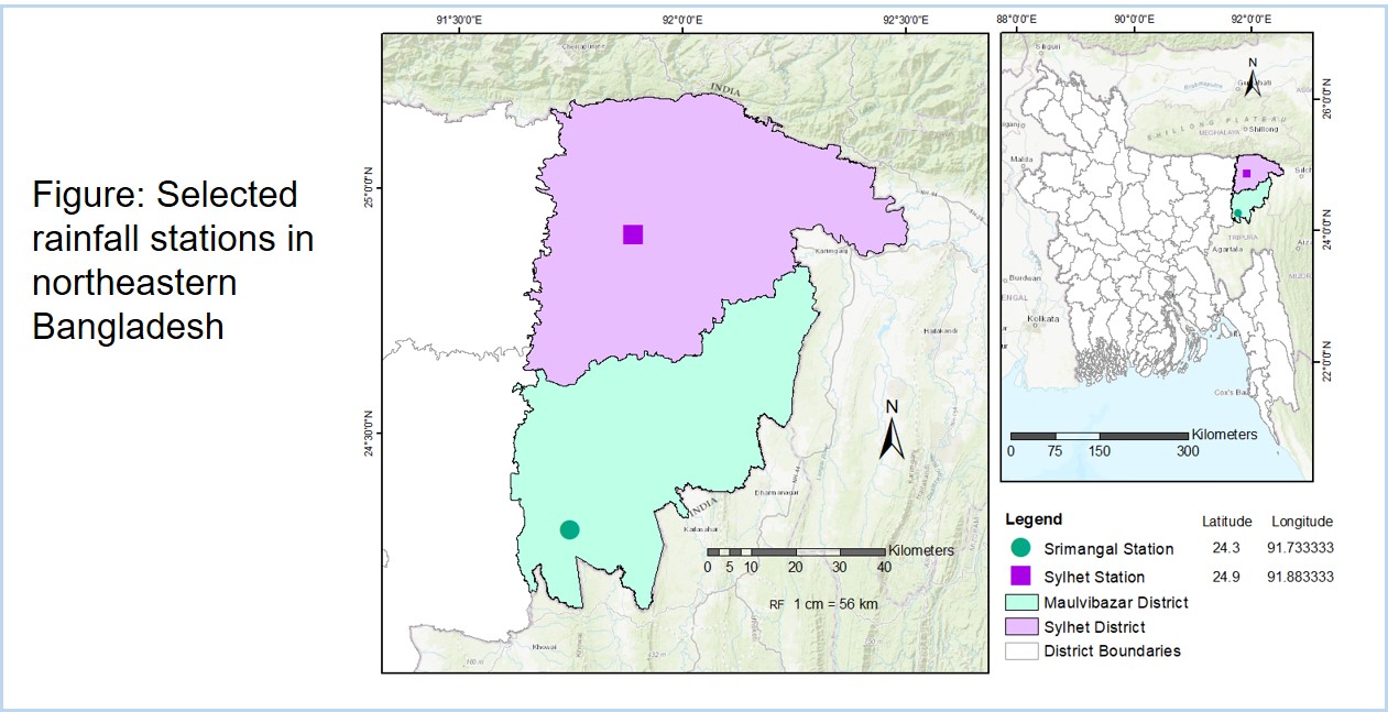
Figure: Study area
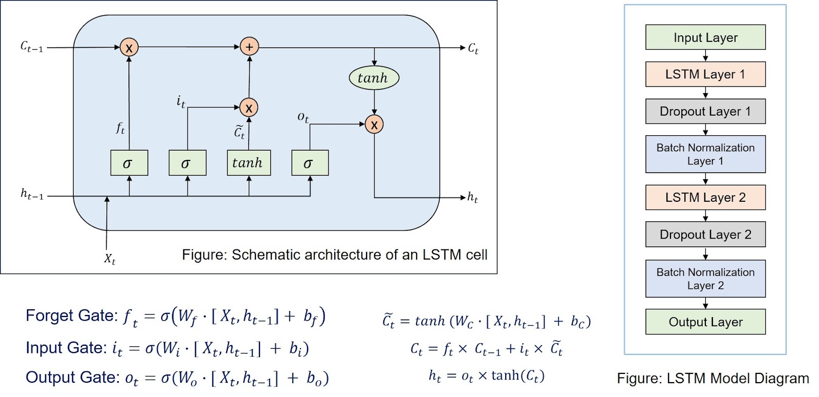
Figure: LSTM model implemented
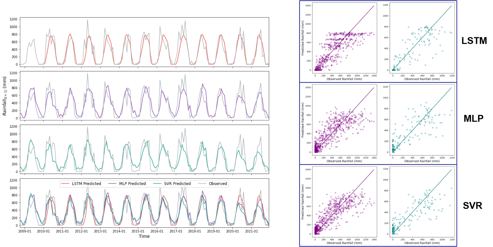
Figure: Results for Sylhet station
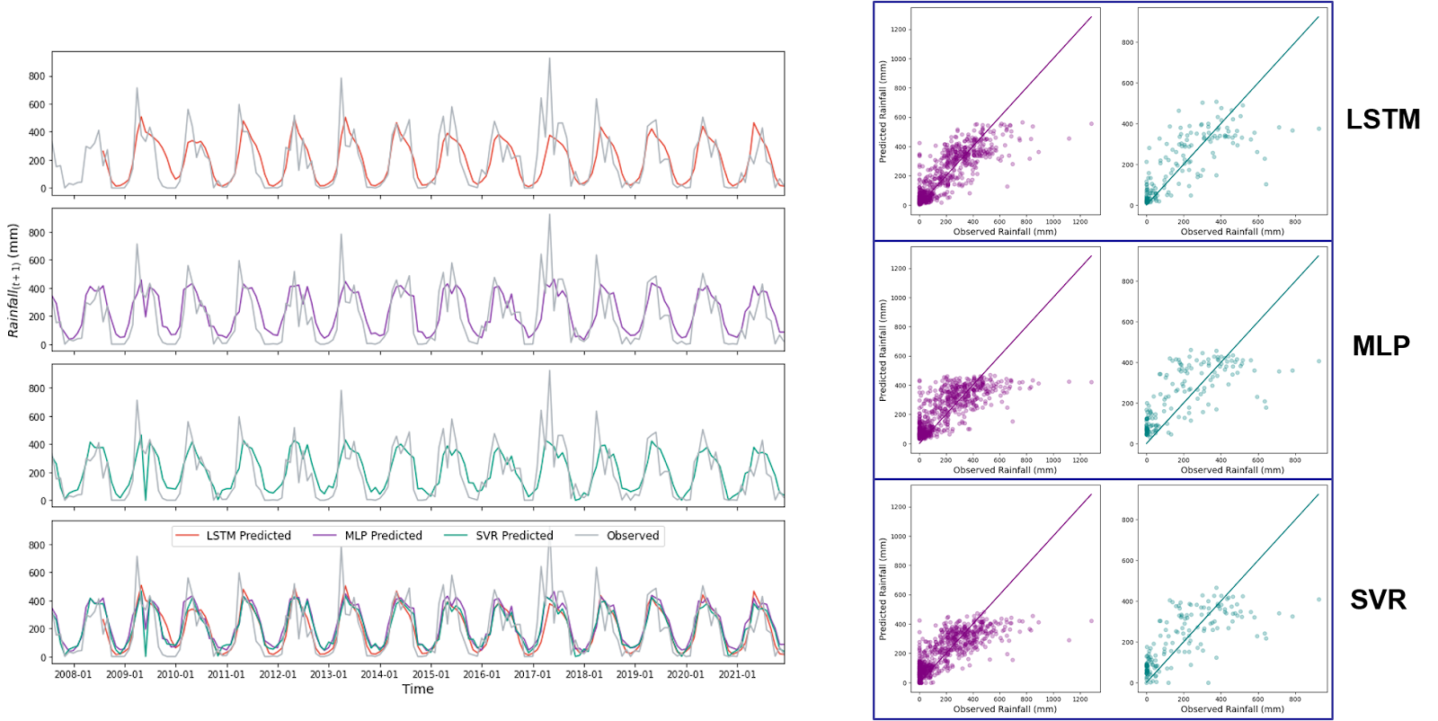
Figure: Results for Srimangal station
Presented at the 7th International Conference on Civil Engineering for Sustainable Development (ICCESD 2024) on 8th February 2024.
AIP Conference Proceedings. (2025, February). Authors: Mondol, S. C., Adhikary, S. K., Nath, H., & Shuvo, S. P. DOI: 10.1063/5.0247626
View PublicationPrediction of Monthly Rainfall in Bangladesh using Artificial Intelligence Techniques
Undergraduate ThesisSupervisor: Professor Dr. Sajal Kumar Adhikary
This study implemented three machine learning models, artificial neural network (ANN), genetic programming (GP), and support vector machine (SVM), to predict rainfall in eight stations in Bangladesh through a multivariate approach from a list of hydrometeorological and climatic variables. I implemented a feature selection method consisting of autocorrelation- partial autocorrelation function (ACF-PACF) analysis, cross-correlation function (CCF) analysis, and Pearson correlation analysis. The best performing model differed for different stations. Although the feature selection improved the performance of ANN and SVR, this doesn’t hold for GP.
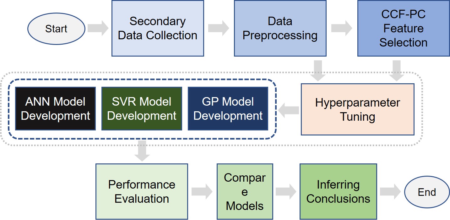
Figure: Study design
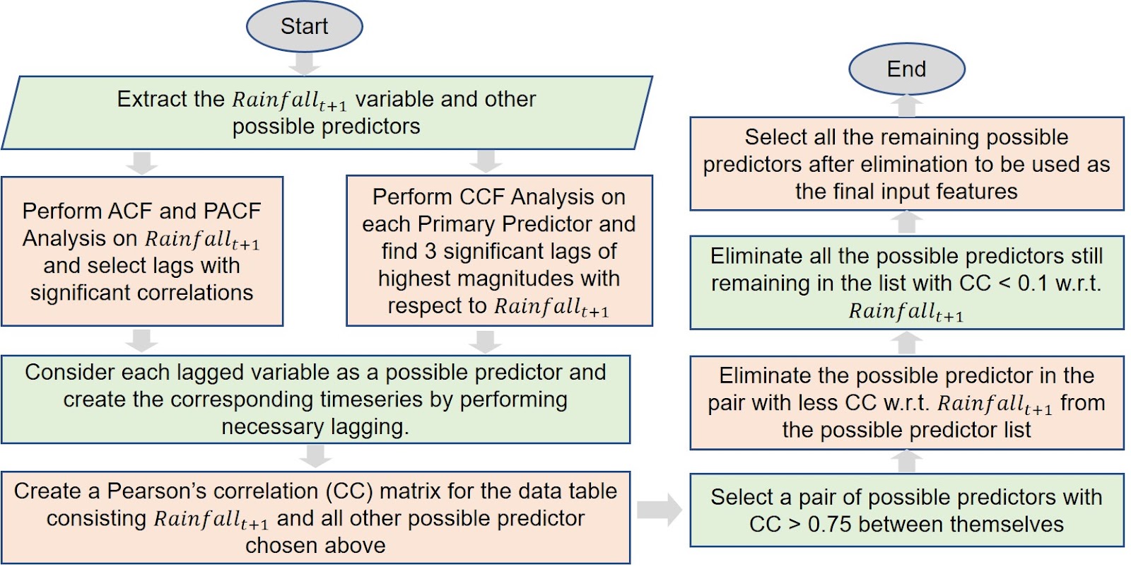
Figure: Feature selection workflow
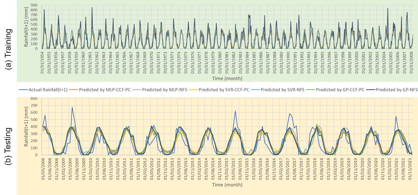
Figure: Results for Dhaka station
Class Projects
Simulating Flow Routing through a River Reach with Structure(s) and its Floodplain
CE 533 - Advanced Hydraulic Routing (Winter 2025)
In this progressive compilation, I explored two-dimensional hydraulic routing based on HEC-RAS and SRH-2D models. It involved preparing necessary input data such as DEM rasters, land cover polygons, boundary conditions, etc., generating suitable mesh or grids, and performing sensitivity analysis by changing the model parameters, mesh properties, and boundary extent. Integrating bridge and culvert structures into the mesh made it more interesting to make that part behave differently and examine the difference in simulated outputs.
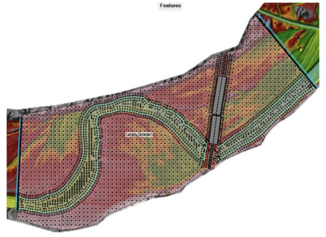
Figure: Final plan (with structures) for RAS simulation
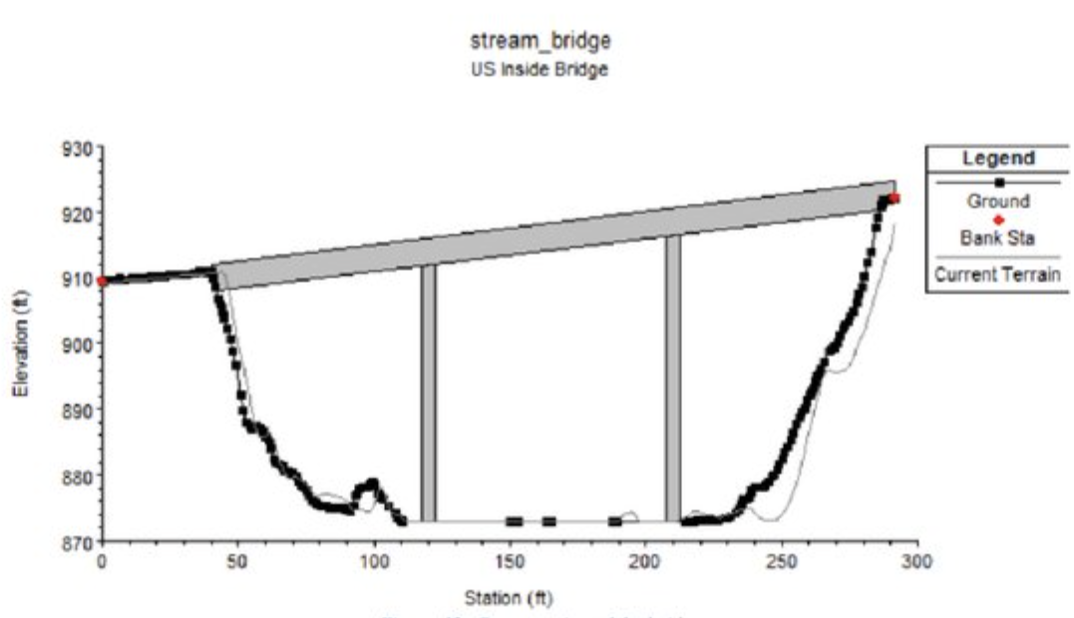
Figure: Cross-section of the bridge integrated in the RAS model
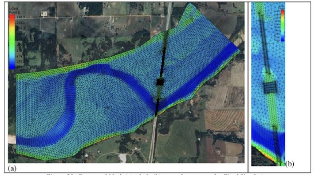
Figure: Generated mesh (a) whole and (b) in and around structures for SRH-2D
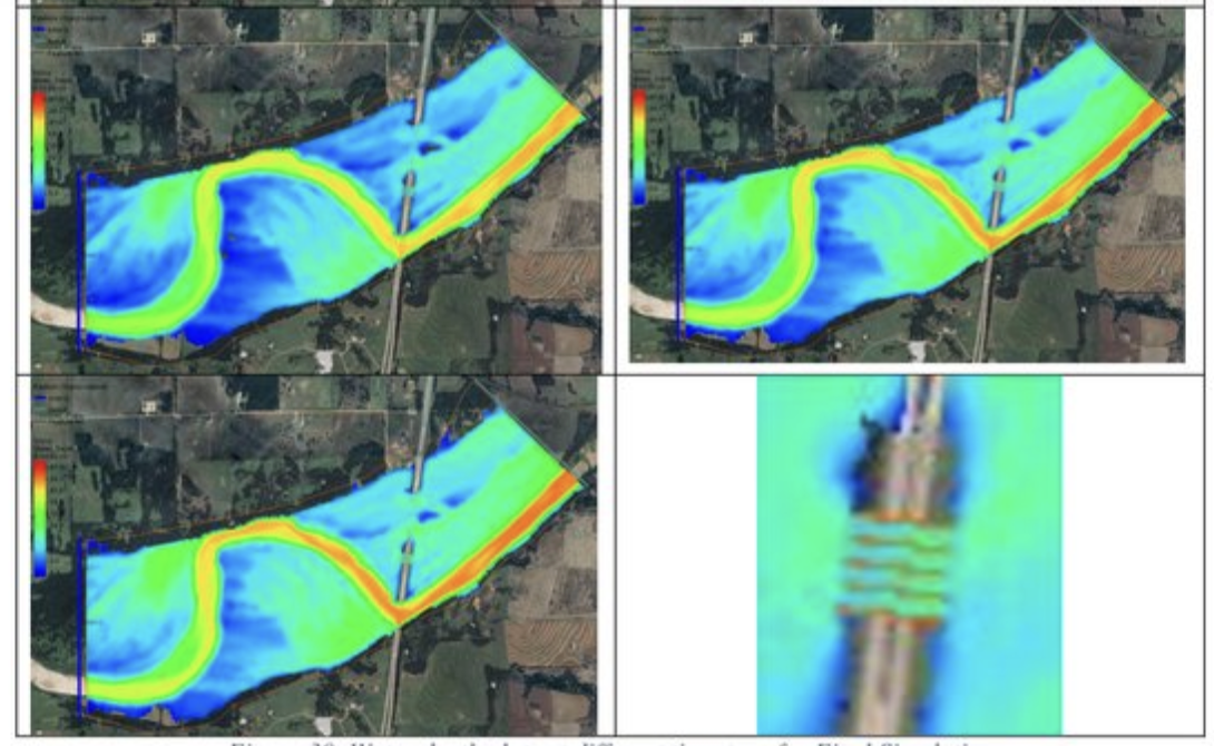
Figure: SRH-2D simulated water depth plots at different timesteps
NWM-based Web Application and QGIS Plugin Development
CE 514 - Geospatial Software Development (Winter 2025)
The web application provides an interface to access, visualize, and present National Water Forecast products of all three ranges. It includes a Leaflet map showing several reaches on state boundaries. The user can select the intended reach and forecast type from the sidebar menu or the button floated on point selection from the map and a dropdown, respectively. The app primarily presents the data as a timeseries plot and a table. It also displays a comment on flood and drought risk by comparing with return periods and a drought threshold.
View Web AppThe developed QGIS plugin enables a window-based interface to access and present NWM forecast visualizations.
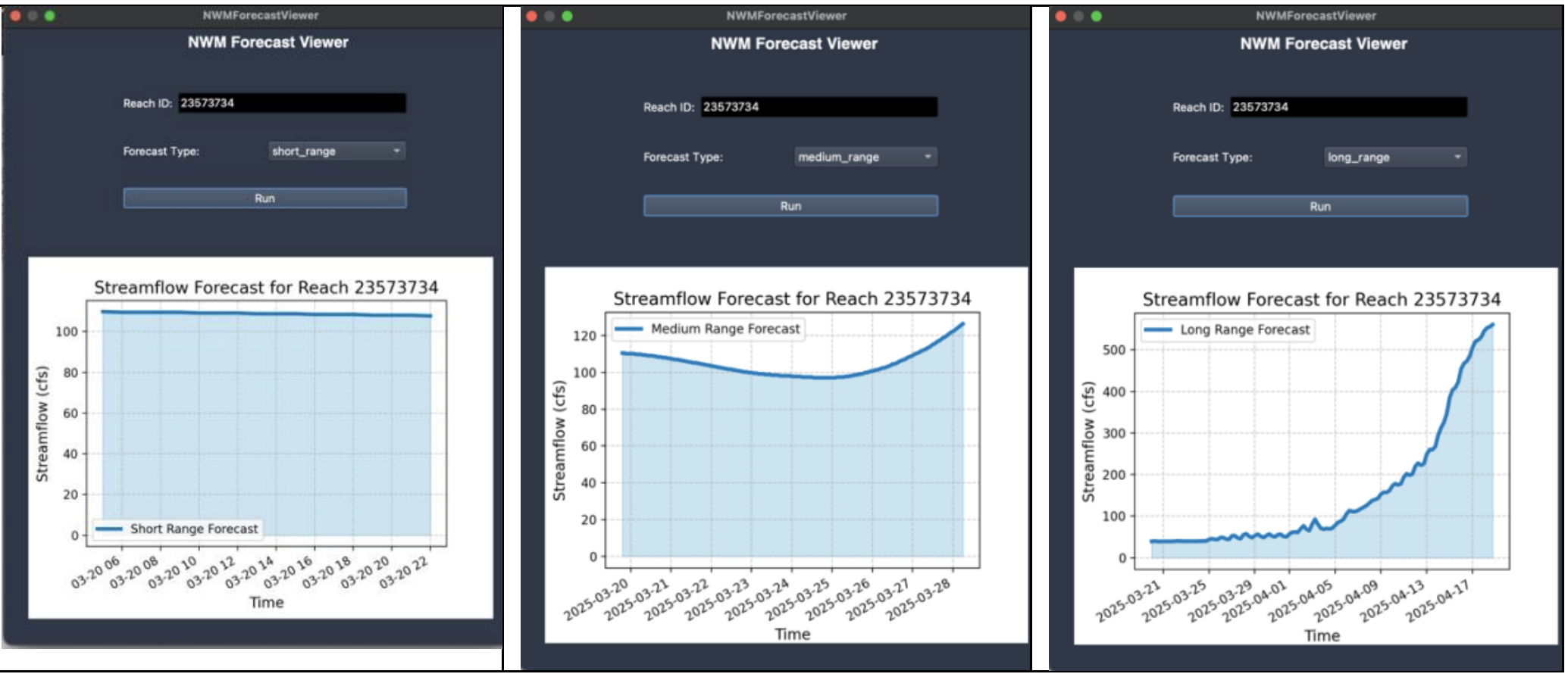
Figure: QGIS Interfaces for NWM Forecast Viewer Plugin
Hydrologic Modeling of Big Sulphur Creek near Cloverdale Watershed
CE 531 - Hydrologic Modeling (Fall 2024) [Group project with Mahjarin, T.]
This semester-wide project explores lumped and distributed hydrologic modeling using the HEC-HMS and the Gridded Surface Subsurface Hydrologic Analysis (GSSHA) model engines in the Watershed Modeling System (WMS) platform. In addition to enriching the model by adding more components and progressively trying alternative features, we performed sensitivity analysis and explained the effectuated variations in light of hydrologic principles.
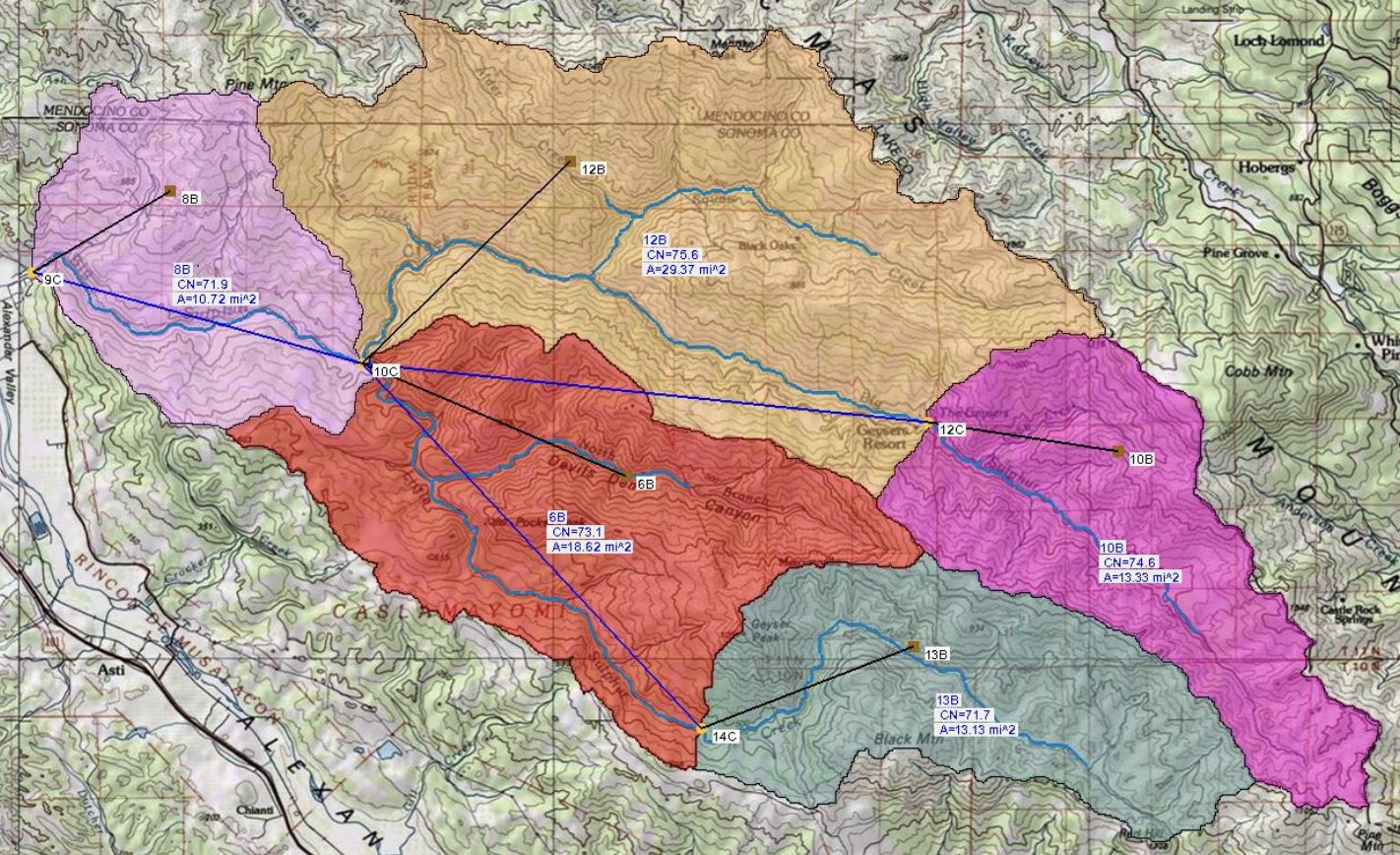
Figure: Lumped modeling with HMS (WMS)
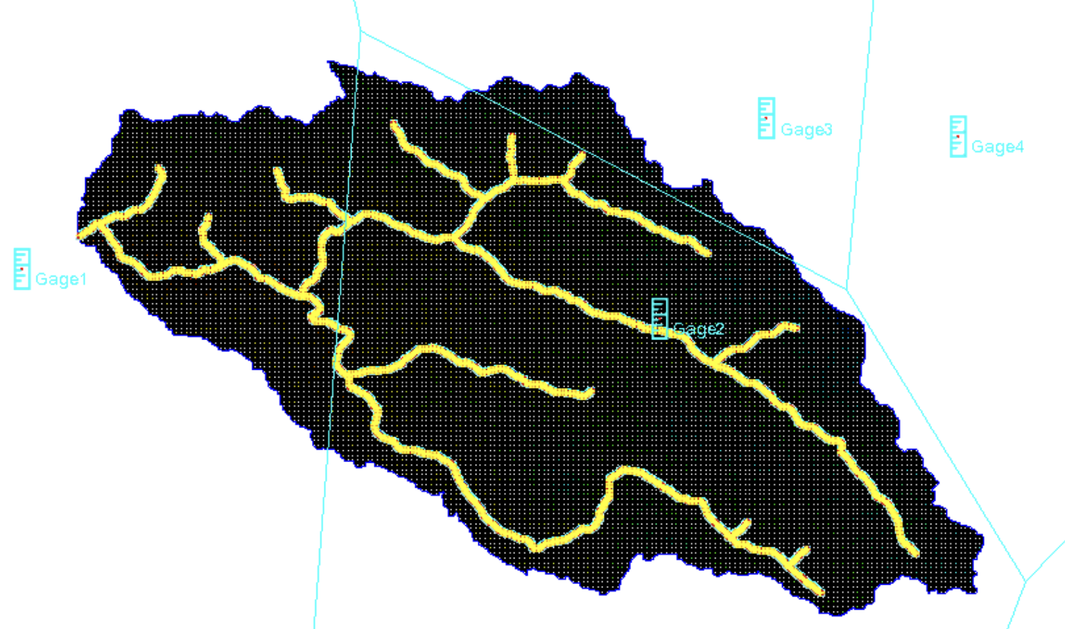
Figure: Distributed modeling with GSSHA (in WMS)
Deep learning based short-term water demand forecasting for the water distribution system in Bluffdale, Utah
CE 532 - Urban Water Infrastructure (Fall 2024)
This project explores deep learning-based forecasting of water demand in Bluffdale City, Utah, considering its scope on short-term water supply operations and management. The study uses only about two months of water use data and atmospheric variables data for the multivariate approach. The LSTM model shows promising performance in the univariate approach, while the multivariate approach falls behind a multiple linear regression model. The absence of feature selection or the quality of atmospheric feature data might result in this inferiority of the multivariate model.
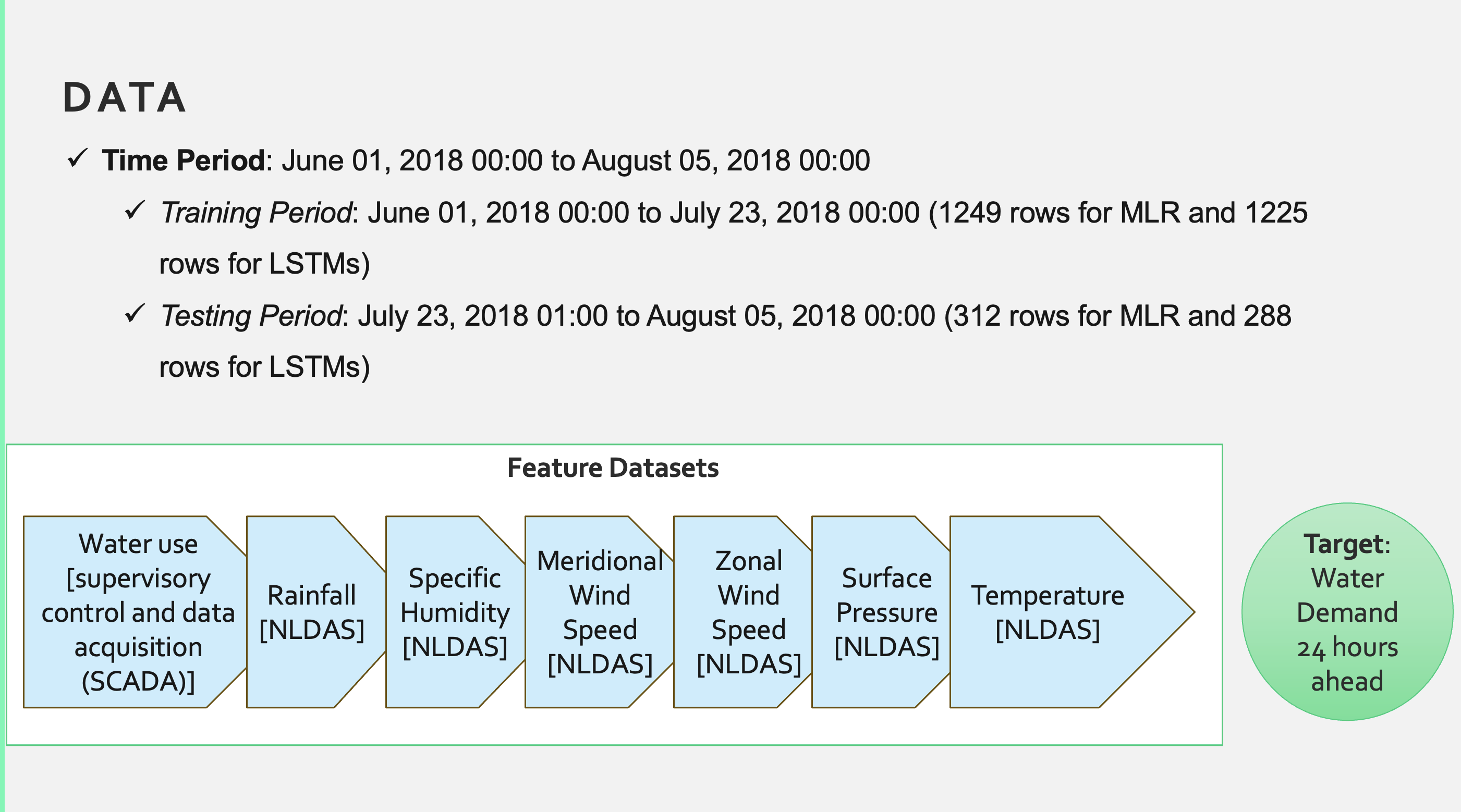
Figure: Data and features
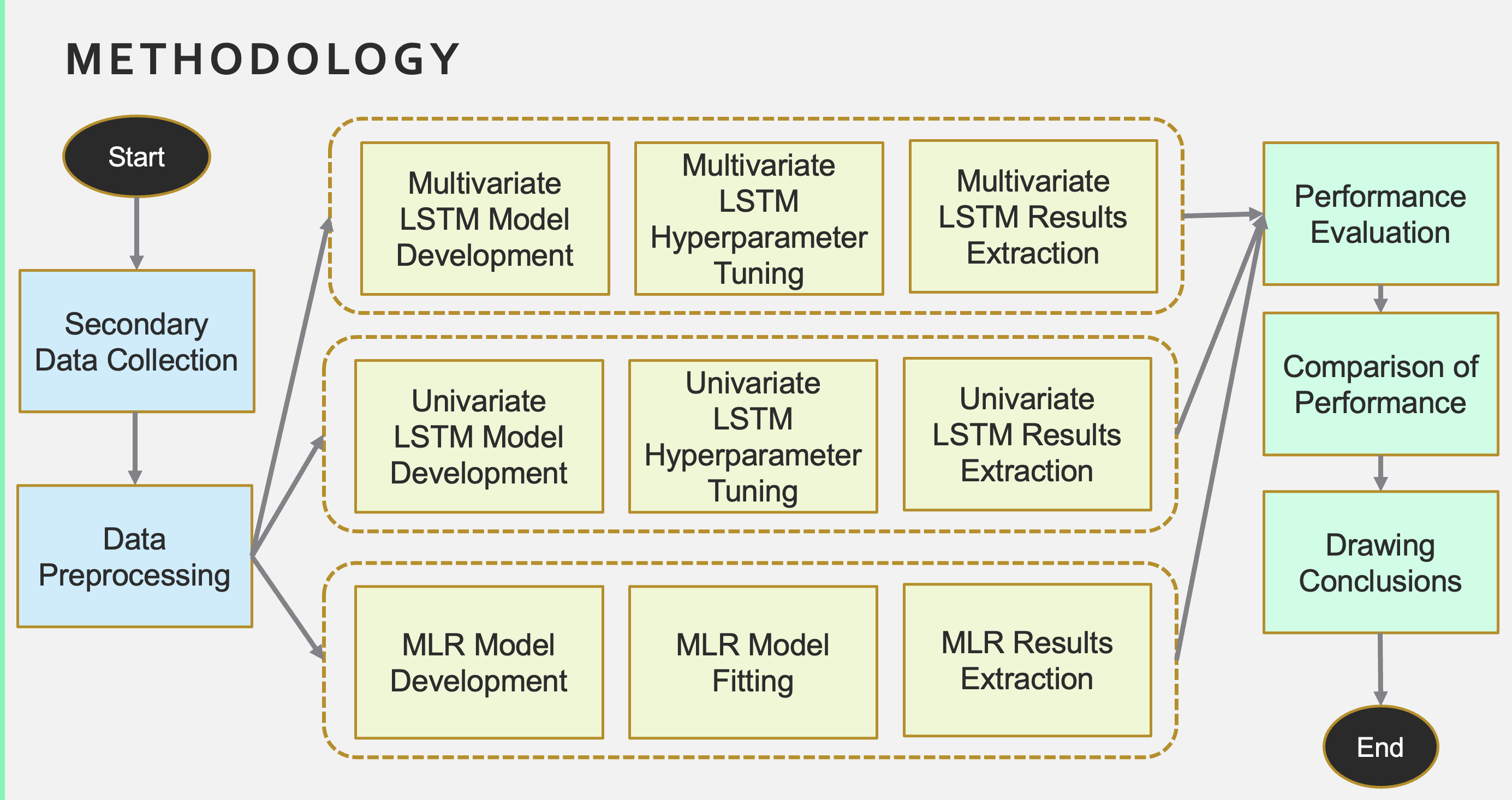
Figure: Study design
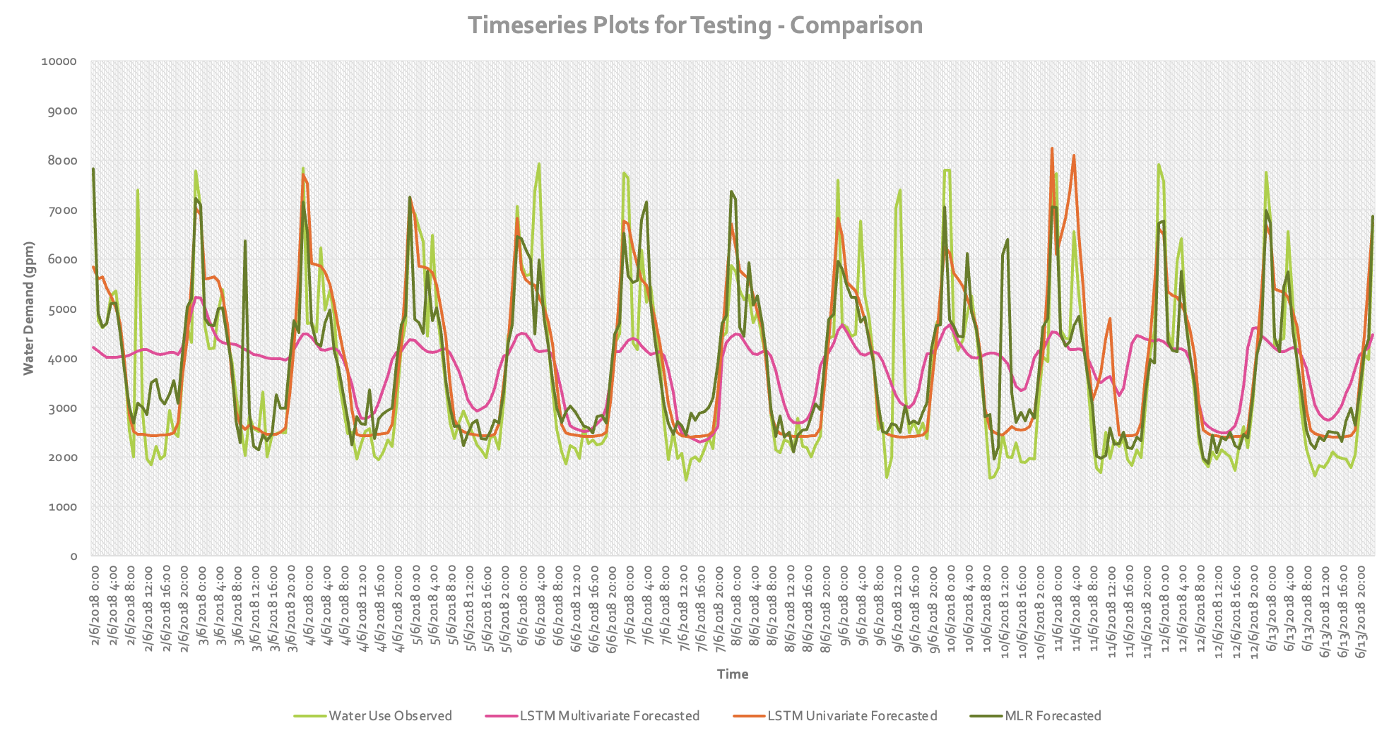
Figure: Timeseries comparison on test dataset
Figure: Boxplot comparison on test dataset
Mapping Community Drought Vulnerability for California
CE 414 - Engineering Applications of GIS (Fall 2024) [Group project with Mahjarin, T.]
This project mapped the community drought vulnerability by considering hydrometeorological and community indicators. It used the Advance Drought Response Index (ADRI), a compound index combining four other drought indices, namely the vegetation condition index (VCI), temperature condition index (TCI), precipitation condition index (PCI), and soil condition index (SCI). The study used a made-up index using the social vulnerability and community resilience scores from the FEMA National Risk Index dataset to incorporate the community aspect. We ran the overall workflow in a custom ArcGIS Model Builder model blended with various vector and raster-based tools.
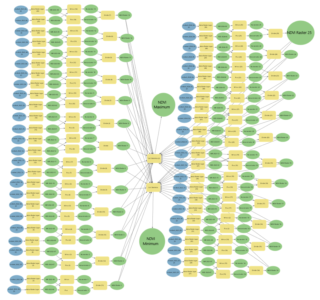
Figure: Workflow for NDVI raster generation
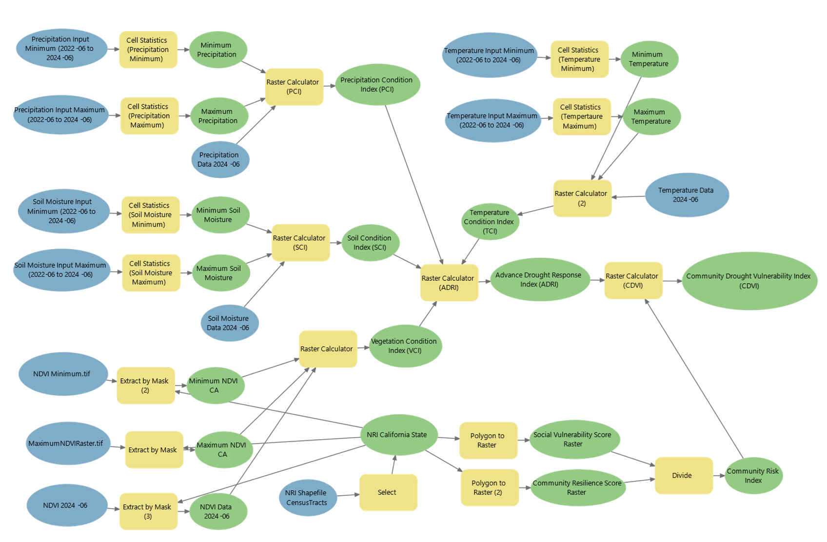
Figure: Overall Workflow for CDVI Raster
Last updated: October 5, 2025